
Satellite imagery has revolutionized how we explore and plan our journeys, offering unprecedented access to Earth’s landscapes from above. 🌍
Gone are the days when travelers relied solely on paper maps, guidebooks, and word-of-mouth recommendations. Today’s adventurers have access to powerful satellite technology that transforms trip planning into an immersive, visual experience. Whether you’re backpacking through remote mountain ranges, planning a road trip across unfamiliar territories, or scouting the perfect beach destination, satellite imagery provides insights that were once available only to military and scientific organizations.
The integration of satellite imagery into travel planning tools has democratized exploration, allowing anyone with an internet connection to survey destinations before setting foot on the ground. This technological leap forward has practical implications for safety, efficiency, and overall travel satisfaction.
🛰️ Understanding Satellite Imagery Technology in Travel Context
Satellite imagery refers to photographs of Earth captured by satellites orbiting our planet. These images range from low-resolution snapshots covering vast areas to high-resolution pictures detailed enough to identify individual buildings, vehicles, and natural features. Modern satellites capture data across multiple spectrums—visible light, infrared, and radar—providing diverse information about terrain, vegetation, water bodies, and human infrastructure.
For travelers, this technology translates into actionable intelligence. You can assess trail conditions before a hike, identify parking areas near attractions, evaluate beach accessibility, or determine the actual proximity of hotels to points of interest. The accuracy and recent nature of satellite data help travelers make informed decisions that enhance safety and enjoyment.
Major mapping platforms update their satellite imagery regularly, though frequency varies by location. Popular tourist destinations typically receive more frequent updates than remote areas. Understanding this limitation helps travelers use satellite imagery more effectively as part of a comprehensive planning strategy.
Transforming Pre-Trip Research with Aerial Perspectives
Traditional travel research often leaves gaps between expectation and reality. Hotel descriptions might promise “beachfront” locations that actually sit hundreds of meters from shore. Hiking trail descriptions might understate difficulty by omitting visual terrain details. Restaurant reviews might not mention limited parking or challenging access routes.
Satellite imagery fills these gaps by providing objective visual evidence. You can verify claims made in marketing materials, assess the actual character of neighborhoods, and identify alternative routes or backup options. This visual verification system reduces unpleasant surprises and helps travelers align their expectations with reality.
The bird’s-eye perspective also reveals contextual information that ground-level photos cannot convey. You might discover that your planned accommodation sits beside a major highway, that a seemingly isolated resort is actually part of a sprawling development, or that a “secluded” beach has extensive public access points nearby.
Evaluating Accommodation Locations with Precision
Choosing the right accommodation location significantly impacts travel experiences, yet traditional booking photos rarely show surrounding context. Satellite imagery allows you to examine the immediate neighborhood, assess proximity to amenities, identify potential noise sources like airports or railways, and verify access to transportation networks.
For vacation rentals especially, satellite views help verify property descriptions. You can confirm the presence of advertised pools, gardens, or private beach access. You can also assess privacy levels by viewing neighboring properties and their proximity. This due diligence becomes particularly valuable when booking in unfamiliar destinations where you lack local knowledge.
Satellite imagery also helps identify practical considerations often overlooked in accommodation selection. Is there adequate street parking? Are there steep hills between the property and public transportation? Is the building actually surrounded by construction sites? These details emerge clearly from aerial perspectives.
🗺️ Enhancing Route Planning and Navigation Strategies
Route planning extends beyond simply connecting point A to point B. Experienced travelers consider scenic value, rest stop availability, road conditions, and alternative options. Satellite imagery elevates route planning by providing visual confirmation of these factors before departure.
For road trips, satellite views reveal scenic detours, identify rest areas with parking capacity, and highlight potentially challenging road segments. Mountain routes that appear straightforward on conventional maps might reveal themselves as narrow, winding passages when viewed from above. Coastal highways might showcase breathtaking viewpoints worth adding to your itinerary.
Adventurous travelers planning off-road excursions benefit enormously from satellite analysis. You can identify terrain types, assess vehicle accessibility, locate water crossings, and plan camping spots in advance. This preparation proves invaluable in remote areas where internet connectivity may be limited or nonexistent during the actual journey.
Identifying Hidden Gems and Alternative Destinations
Some of travel’s most memorable experiences come from discovering places that don’t appear in guidebooks. Satellite imagery facilitates this discovery process by allowing you to visually explore areas surrounding popular destinations. That secluded cove might be accessible via a short trail. An unmarked viewpoint might offer better perspectives than crowded tourist overlooks.
Virtual exploration through satellite imagery can reveal parks, beaches, historic sites, and natural wonders that haven’t yet entered mainstream tourism circuits. By zooming out from popular attractions and systematically examining surrounding areas, curious travelers can build unique itineraries that avoid crowds while maximizing authentic experiences.
This exploration technique works particularly well in coastal regions, mountain areas, and rural landscapes where natural attractions exist beyond documented trails and official viewpoints. The key is combining satellite imagery with topographic maps and local trail databases to assess accessibility and difficulty levels.
Adventure Planning for Outdoor Enthusiasts 🏔️
Outdoor adventurers—hikers, climbers, kayakers, and cyclists—gain substantial advantages from satellite imagery integration. Planning wilderness experiences requires understanding terrain, identifying water sources, assessing vegetation density, and recognizing potential hazards. Satellite data provides these insights more effectively than traditional topographic maps alone.
Hikers can examine trail conditions, identify steep sections, locate scenic viewpoints, and assess camping locations before committing to multi-day treks. The ability to visualize terrain three-dimensionally helps gauge difficulty levels more accurately than elevation profiles alone. You can also identify bailout routes and emergency access points—critical safety considerations for remote adventures.
Water enthusiasts benefit from satellite views of coastlines, rivers, and lakes. Kayakers can identify launch points, assess current patterns by observing water color variations, and spot potential hazards like reefs or shallow areas. Surfers can evaluate beach approaches, parking availability, and crowd levels at various breaks along a coastline.
Safety Considerations Through Aerial Intelligence
Safety should always rank as a top priority in travel planning, and satellite imagery provides valuable risk assessment capabilities. You can identify evacuation routes, locate emergency services facilities, assess flood risk in low-lying areas, and recognize fire-prone vegetation zones in wilderness areas.
For international travelers visiting unfamiliar regions, satellite imagery helps assess security considerations. You can examine the layout of neighborhoods, identify well-lit main thoroughfares versus isolated alleys, and locate police stations or embassy locations relative to your accommodation. While not a substitute for official travel advisories, this visual intelligence adds another layer to personal safety planning.
Natural disaster preparedness also benefits from satellite analysis. Coastal travelers can visualize tsunami evacuation routes and high-ground options. Those visiting earthquake-prone regions can identify open spaces suitable for emergency assembly. Travelers heading to areas with severe weather risks can assess their accommodation’s exposure to potential hazards.
Practical Applications Across Travel Categories
Different types of travelers extract unique value from satellite imagery integration. Business travelers might use it to assess conference venue locations, identify nearby dining clusters, and plan efficient routes between meeting locations. Family vacationers can verify playground proximity, assess beach safety by examining wave patterns, and identify family-friendly restaurants with parking.
Solo travelers particularly benefit from the safety and orientation advantages satellite imagery provides. Familiarizing yourself with neighborhood layouts, identifying landmarks, and planning multiple route options builds confidence when exploring unfamiliar cities alone. This preparedness reduces vulnerability and enhances the solo travel experience.
Luxury travelers can verify the exclusivity and privacy claims of high-end resorts by examining property layouts and surrounding development. Adventure travelers can scout challenging routes and assess difficulty levels. Cultural tourists can identify architectural features and historical site layouts that might not be apparent from ground-level descriptions.
Urban Exploration and City Tourism
Cities present unique planning challenges with their dense layouts, complex transportation networks, and diverse neighborhoods. Satellite imagery helps urban explorers understand city structure, identify walkable districts, locate green spaces, and assess the character of different neighborhoods before arrival.
You can trace historical city walls, identify architectural patterns, locate rooftop terraces with views, and find shortcuts between attractions. Markets, parks, and pedestrian zones become clearly visible from above, helping you construct efficient walking routes that maximize sightseeing while minimizing backtracking.
Urban satellite imagery also reveals transportation infrastructure details often unclear on standard maps. You can identify bike lane networks, assess subway station surroundings, locate bus terminals, and evaluate parking availability near attractions. This information proves invaluable for deciding between transportation modes and planning logistics.
🌟 Integrating Satellite Imagery with Modern Travel Apps
The real power of satellite imagery emerges when integrated with specialized travel planning applications. Several platforms now combine satellite views with user-generated content, real-time data, and trip planning tools to create comprehensive solutions.
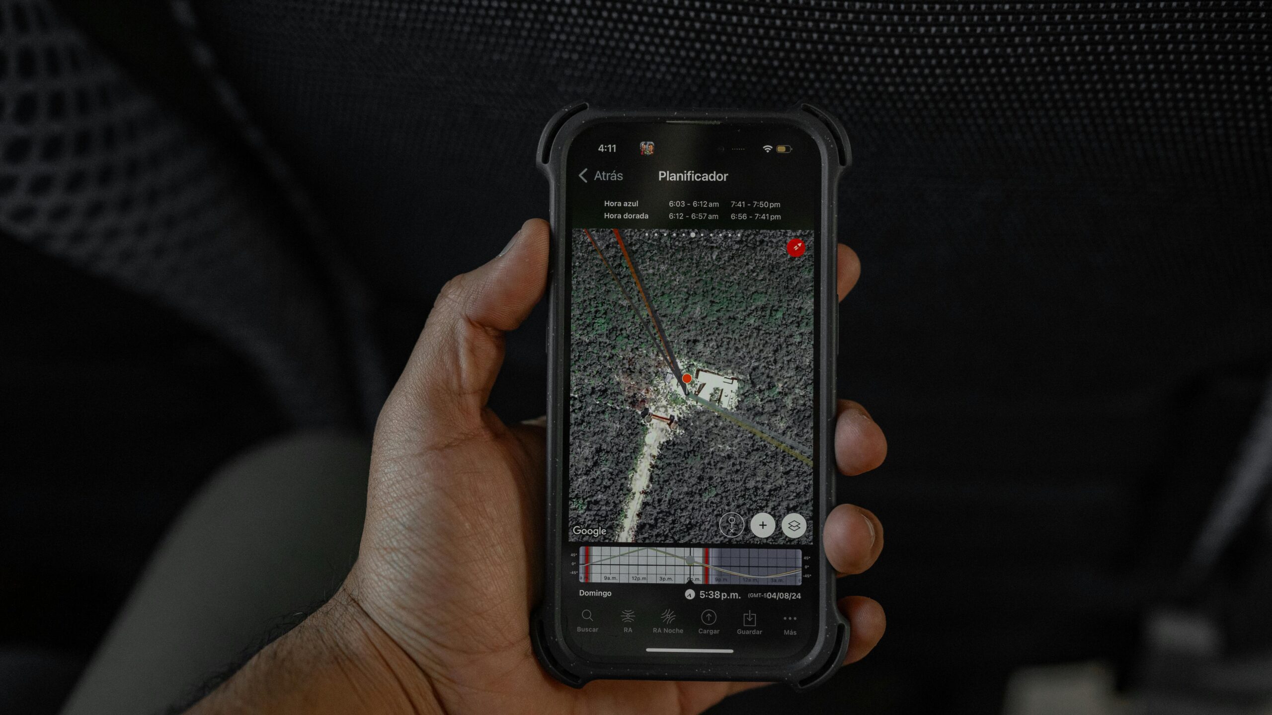
Google Earth stands as the most recognized platform, offering global satellite coverage with historical imagery comparison, 3D terrain visualization, and street-level integration. Its measurement tools allow travelers to calculate distances, assess elevations, and plan routes with precision. The platform’s layering system lets you overlay trails, points of interest, and user-contributed information onto satellite imagery.
Specialized outdoor apps combine satellite imagery with topographic mapping, trail databases, and navigation features. These platforms allow you to download imagery for offline use—critical for wilderness adventures where connectivity is unavailable. Many include community features where users share route notes, photos, and condition updates.
Photography enthusiasts benefit from apps that combine satellite imagery with solar positioning data, helping scout shooting locations, predict lighting conditions, and identify compositions before visiting. These tools save valuable time during photo expeditions by eliminating guesswork from location scouting.
Real-Time Updates and Dynamic Planning
Modern satellite technology increasingly provides near-real-time imagery, enabling dynamic travel planning that responds to current conditions. You can assess wildfire smoke impacts on scenic areas, evaluate storm damage to infrastructure, or confirm snow coverage at mountain destinations. This real-time intelligence allows travelers to adjust plans based on actual current conditions rather than seasonal assumptions.
Some platforms now integrate satellite imagery with social media feeds, showing recent photos taken at specific locations overlaid on satellite views. This combination provides both the big picture context and ground-level reality, creating a comprehensive understanding of destinations before arrival.
Weather visualization layers added to satellite imagery help travelers understand microclimates, prevailing wind patterns, and typical cloud cover. These details matter for activities like sailing, paragliding, or photography where weather conditions critically affect experiences.
Overcoming Limitations and Maximizing Effectiveness
Despite its power, satellite imagery has limitations travelers should understand. Image resolution varies significantly by location, with remote areas often showing only low-resolution coverage. Update frequency differs widely—popular destinations might receive monthly updates while remote regions show imagery several years old.
Weather conditions at image capture time affect quality. Cloud cover obscures ground details, while seasonal variations mean summer imagery might not accurately represent winter conditions. Some sensitive locations have deliberately degraded resolution for security reasons, limiting usefulness for detailed planning.
To maximize effectiveness, combine satellite imagery with multiple information sources. Cross-reference with topographic maps, recent traveler photos, local tourism resources, and on-the-ground reports from recent visitors. This multi-source approach builds the most accurate picture of destinations.
Privacy and Ethical Considerations
While satellite imagery provides unprecedented planning capabilities, responsible use requires consideration of privacy and ethical implications. Avoid using detailed imagery to intrude on private property beyond what’s necessary for legitimate travel planning. Respect local regulations in areas where photography or surveillance is restricted.
Share useful discoveries with the travel community while being mindful of fragile locations that could be damaged by increased visitation. Some pristine natural areas benefit from remaining undiscovered. Balance the desire to explore hidden gems with responsibility to preserve them for future generations.
🚀 Future Developments in Satellite Travel Planning
Satellite technology continues advancing rapidly, promising even more powerful travel planning capabilities. Higher resolution imagery approaches the clarity of aerial photography while maintaining global coverage. Increased update frequencies will provide near-real-time views of popular destinations.
Artificial intelligence integration will automate discovery of interesting locations based on visual patterns, potentially identifying undiscovered attractions algorithmically. Machine learning could analyze satellite imagery to assess trail difficulty, predict parking availability, or estimate crowd levels at attractions.
Augmented reality applications will overlay satellite-derived information onto real-world views through smartphone cameras, creating seamless bridges between planning and on-the-ground navigation. Virtual reality integration might allow fully immersive pre-trip exploration of destinations from home.
Specialized satellite sensors will provide data beyond visible light—thermal imaging could verify beach temperatures, multispectral analysis could assess vegetation health in parks, and radar could penetrate cloud cover for consistent tropical destination monitoring. These enhanced capabilities will make satellite imagery even more valuable for specialized travel planning.
Making Satellite Imagery Part of Your Planning Routine
Incorporating satellite imagery into travel planning requires developing new habits and skills. Start by examining every potential destination from multiple altitudes—zoomed out for context, zoomed in for details. Compare different imaging dates to understand seasonal changes. Measure distances to verify walkability claims.
Create custom maps by marking points of interest, saving imagery, and annotating with notes from your research. Many platforms allow sharing these custom maps with travel companions, facilitating collaborative planning. Build libraries of potential destinations organized by region or activity type for future reference.
Practice interpreting satellite imagery to develop visual literacy. Learn to recognize terrain types, assess vegetation density, identify infrastructure, and spot potential obstacles. This skill improves with experience, making you increasingly effective at extracting valuable planning intelligence from aerial perspectives.
The integration of satellite imagery into travel planning represents a fundamental shift in how we explore our world. This technology empowers travelers with knowledge previously unavailable, enhancing safety, efficiency, and experience quality. By developing proficiency with these tools, you transform from passive trip-taker to informed explorer, equipped to discover and navigate destinations with unprecedented confidence and capability. The sky truly is no longer the limit—it’s your planning advantage. ✈️